
Services
River engineering × IT. We work with you from the first conversation through delivery and beyond.
How we work
Consultation
We listen to your challenges, goals and current situation. It is fine if you are not sure which service fits. Consultations are free.
Proposal & estimate
We propose what to compute or build, with deliverables, approach, schedule and cost.
Agreement
Once you are satisfied with the plan, we sign an agreement. We work with the procedures of government, universities and companies.
Development & analysis
We work in small steps and show interim results, confirming direction in meetings and adjusting as needed.
Delivery & report
We deliver the results and report what was done and what remains, handing everything over in a form you can keep using.
Ongoing support
After delivery we continue to help with maintenance, training and new features.
Service categories
AI & COACHING
AI Adoption & Coaching
Helping teams build and keep building with AI.
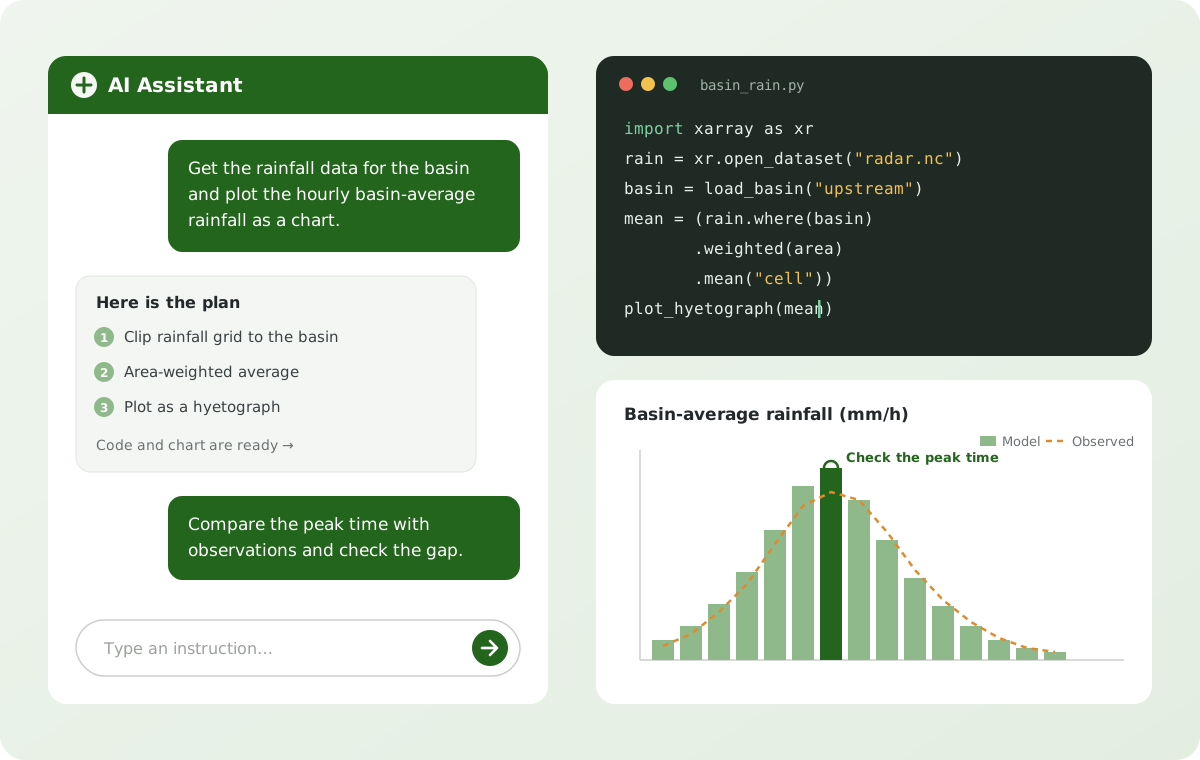
Every day we design, build and run software and systems together with AI. We pass on what we have learned in practice to engineers and organizations, and we support iRIC and programming training from course materials through to hands-on follow-up.
iRIC online workshops
Online workshops from introductions to Nays2DH and Nays2DFlood to building computational grids.
AI-assisted programming courses
Learn data processing in Python by instructing AI and checking its work, using your own project data.
Online course materials for iRIC Academy
Materials and mini-tests on hydraulics and numerical analysis, offered as an online place to learn.
Hands-on support for adopting AI
From deciding where AI fits in your work to bringing it into development, documentation and back-office tasks, and making it stick.
Typical deliverables
- Training and workshops (materials and exercise data)
- An AI adoption plan and procedures tailored to your work
- AI assistants that answer questions from your own documents
FLOW, INUNDATION & BED EVOLUTION
Flood-Flow, Inundation & Bed-Evolution Analysis
Turning river flow, flooding and bed change into numbers you can trust.
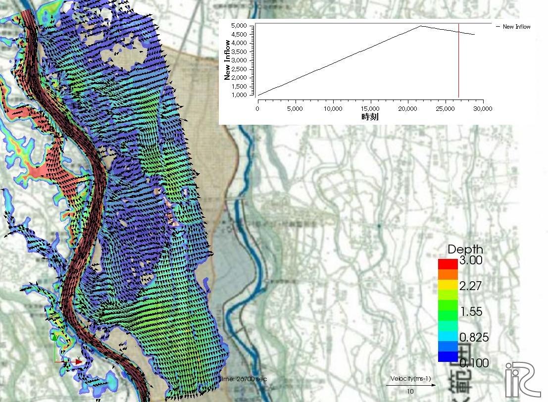
Using iRIC solvers such as Nays2DH and Nays2DFlood, we analyze flood flows, the spread of inundation, and erosion and deposition of the riverbed. Because we build the models, we set conditions with a full understanding of how they work and deliver results in a form that is easy to understand.
Flood-flow analysis
2D analysis of flood water levels and velocities with Nays2DH and others, for river planning and management and reproducing past floods.
Inundation analysis
Analysis of fluvial and pluvial inundation with Nays2DFlood and others, for inundation maps, levee-breach scenarios and evacuation planning.
Bed-evolution analysis
Analysis of riverbed erosion and deposition during floods with Nays2DH and others, for channel maintenance, sediment yield and structures.
Data preparation & visualization
Preparing terrain, rainfall and satellite data for simulation, and presenting results as maps, 3D views and animations.
Typical deliverables
- Analysis reports with figures, charts and animations
- Complete input data, grids and configuration files
- Procedures for re-running the analysis
See our Flood-Flow, Inundation & Bed-Evolution Analysis work →
MODEL DEVELOPMENT
Flood, Inundation & Bed-Evolution Model Development
Turning models into software that lasts.
Drawing on our work designing, developing and maintaining iRIC, we develop and improve flood-flow, inundation and bed-evolution models (solvers) and make them usable on iRIC. We write programs meant to be improved and handed over, not just delivered.
Quasi-3D flood-flow model
Models that capture 3D flow features, such as secondary currents in bends, beyond what 2D models represent.
Mixed-grain-size bed-evolution model
Models that compute the transport of each grain size and changes in bed material where sand and gravel of different sizes are mixed.
Soft-rock erosion model
Models of how exposed soft rock in the riverbed is eroded by flow and repeated wetting and drying.
Other models & iRIC integration
Features such as vegetation, bridge piers and suspended sediment, faster computation, and bringing companies' and institutes' own models into iRIC.
Typical deliverables
- Source code under version control, with a working environment
- Solvers and tools that run on iRIC
- User manuals and developer documentation
See our Flood, Inundation & Bed-Evolution Model Development work →
SYSTEM DEVELOPMENT
System Development
Building the systems that deliver information and keep work running.
From web systems that share river and disaster information to membership, registration and payment platforms and automated data retrieval and forecasting, we handle design, development, UI and operation end to end.
Basin data extraction system
Automatically delineates the basin for a point on the map and extracts the terrain, channel and rainfall data needed for simulation.
Real-time flood simulation system
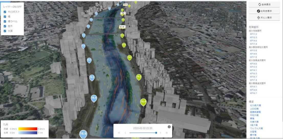
Automatically runs flood and inundation simulations from rainfall and water-level data and presents the results on the web and in 3D.
Cross-section visualization & data tools
Calls up river cross-section surveys from a map and compares them across years, with tools for retrieving the data.
Cloud build & operation
We build on clouds such as AWS and keep maintaining and improving the systems, including membership, registration and payment platforms.
Typical deliverables
- A running web system built on the cloud
- Operation and maintenance procedures and admin manuals
- Ongoing maintenance and improvement