WORKS

Works

Since our founding in 2014, we have delivered more than 260 projects for national research institutes, universities, foundations and engineering consultants. Here is our work by service category.

12 yrsIn business since 2014
260+Projects delivered (FY2014–2025)
39Client organizations
10 yrsConsecutive years maintaining a disaster-information system (since FY2017)

01AI & COACHING

AI Adoption & Coaching

54 projects in this field (2014–2026). The count covers training and technical-support projects.

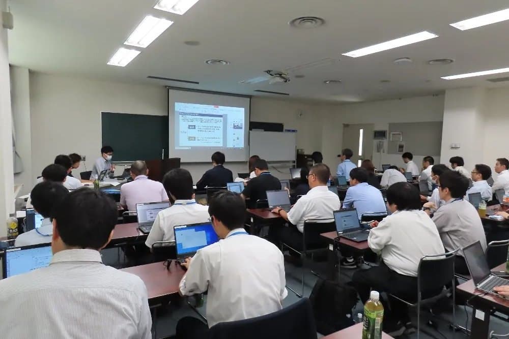
iRIC workshop for engineers of the Hokkaido Regional Development Bureau (Sapporo, 2025)

2014– / Government, municipalities & engineering consultants

iRIC training for engineers

We plan and run iRIC and numerical-analysis workshops for engineers in government and consulting, from beginner to developer level, with hands-on exercises using real project data.

iRICHands-onTeaching materials

iRIC workshop for the Hokkaido Regional Development Bureau (Sapporo, 2025)
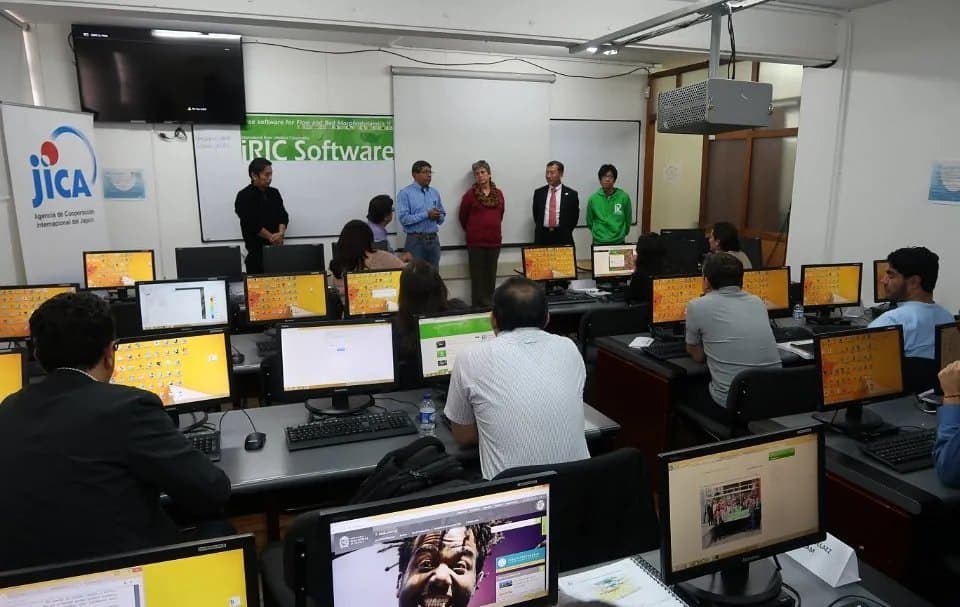
iRIC workshop overseas (hands-on session in a computer room)

2015– / International cooperation & overseas institutes

iRIC training and cooperation overseas

iRIC courses and seminars have been held in more than 20 countries, including Peru, Indonesia, Colombia, Vietnam, Nepal and Thailand. In 2023 we taught at the international iRIC course in Lyon, France, and at an English-language course at PWRI ICHARM.

English coursesInternational cooperationiRIC

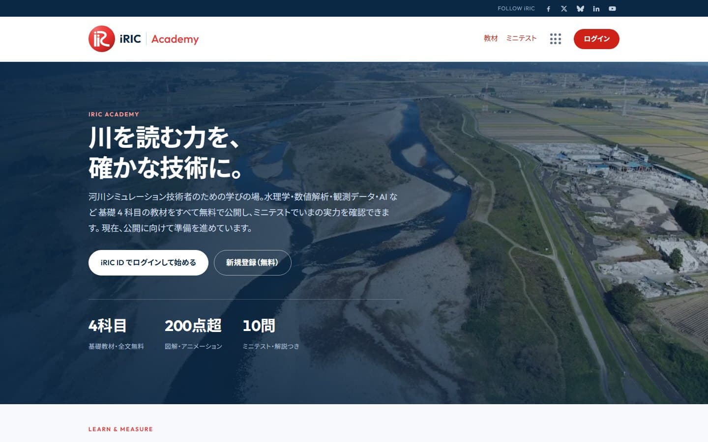
Top page of iRIC Academy

2023– / University & in-house

Course materials and online learning (iRIC Academy)

We created river-simulation materials for university courses, and publish learning materials and mini-tests on hydraulics and numerical analysis as an open online learning space, iRIC Academy.

Course materialsE-learningMini-tests

Selected projects

  • 2014Engineering consultantRiver-engineering course (our first project, in our founding month)
  • 2014Engineering consultantSupporting iRIC workshops for regional development bureau engineers
  • 2017Engineering consultantiRIC developer training and support
  • 2019FoundationBed-evolution study sessions for government staff (exercise data)
  • 2020National research instituteOnline iRIC workshop for a research institute
  • 2021Engineering consultantPython course for river engineers (rainfall and GIS data processing)
  • 2023UniversityRiver-simulation materials for university courses
  • 2025FoundationiRIC exercises for government river engineers

About our AI Adoption & Coaching service →

02NUMERICAL & GEOSPATIAL ANALYSIS

Numerical & Geospatial Analysis

74 projects in this field (2014–2026)

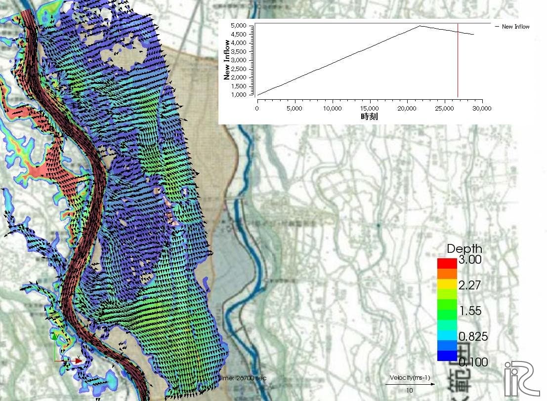
Reproduction of the 2015 Kinu River flood (inundation depth and velocity vectors)

2014– / National research institutes & engineering consultants

Reproducing and forecasting floods

Analyses of flood flows in large rivers, pluvial flooding, sediment runoff, reservoir sedimentation and driftwood. For the 2015 Kinu River flood, we reproduced the event and compared the results with the observed inundation area.

Nays2DFloodNays2DHInundation analysis

Base map: Geospatial Information Authority of Japan

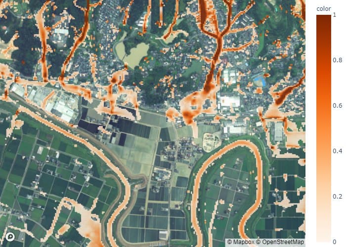
Flow velocity of pluvial flooding over a satellite image

2019 / National research institute

Reproducing pluvial flooding in a heavy-rain disaster

We reproduced the pluvial flooding of the August 2019 heavy rain in northern Kyushu using satellite imagery and terrain data, showing overflow paths and flow speeds under different channel and sluice conditions.

Pluvial floodingNays2DFloodSatellite imagery

Base map: © Mapbox © OpenStreetMap

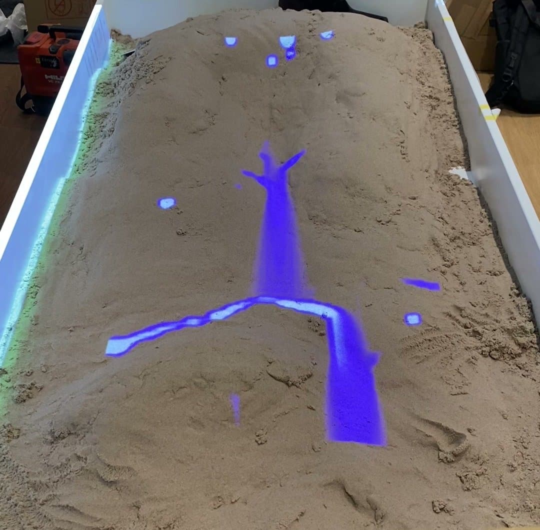
Exhibit projecting water flow onto a sand terrain model

2021 / Private company

Flood simulation for a museum exhibit

An interactive exhibit that projects water flow and flooding onto a sand terrain model. Moving the sand changes how the water flows, letting visitors feel the relationship between landform and water.

Nays2DFloodProjection

Selected projects

  • 2016Engineering consultantChannel safety assessment for a large river's management plan
  • 2018FoundationSediment yield and budget of a mountain basin
  • 2019National research instituteFlood-inundation simulation of small rivers following inundation-assumption guidelines
  • 2019Engineering consultantAssessing channel capacity by combining satellite remote sensing and simulation
  • 2021Engineering consultantReproducing flood flow and bed evolution of the 2019 flood in a large river
  • 2021Engineering consultantBasin GIS database for rivers in southern Kyushu
  • 2023Engineering consultant2D analysis of an overseas river (international cooperation project)
  • 2023Engineering consultantFlood-risk calculation for climate-related financial disclosure (TCFD)
  • 2024Engineering consultant2D river analysis to select candidate water-source sites

About our Numerical & Geospatial Analysis service →

03PROGRAMMING

Programming

130 projects in this field (2014–2026)

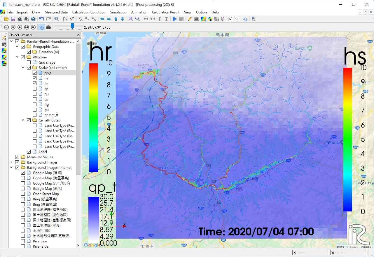
iRIC screen computing the Kuma River basin in the July 2020 heavy rain with the RRI model

2018– / National research institute & university

Bringing the RRI rainfall-runoff-inundation model to iRIC

We implemented the RRI model, which simulates a whole basin from rainfall to flooding, as an iRIC solver and tested it on the July 2020 Kuma River flood. We also built a system that runs nationwide flood forecasts automatically.

RRIiRICReal-time forecasting

Base map: Google Maps

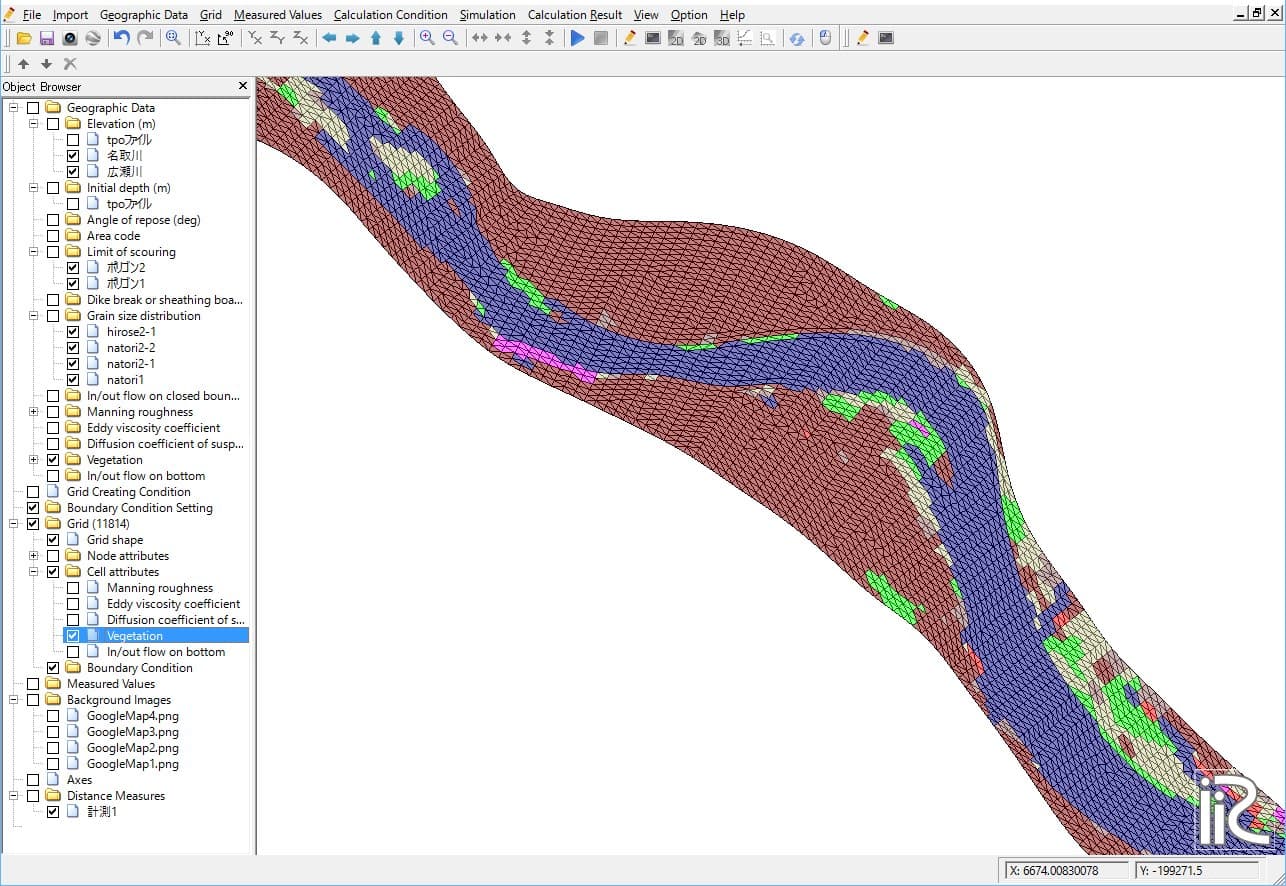
iRIC pre-processor showing vegetation and bed-material distributions on an unstructured grid

2015– / Engineering consultants

Bringing proprietary models into iRIC

We made 2D and quasi-3D models developed in-house by consulting firms usable on iRIC while keeping them private, from unstructured-grid generation and vegetation or bed-material settings to visualization, all in one interface.

iRICSolver integrationUnstructured grid

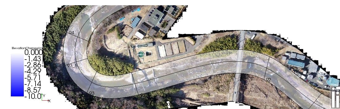
Soft-rock erosion depth shown in color over a drone orthophoto

2018– / Engineering consultants

Bed-evolution model for soft-rock riverbeds

We added soft-rock erosion, vegetation dynamics and bridge-pier effects to Nays2DH, and used drone-surveyed terrain to compute where the rock is eroded.

Nays2DHFortranBed evolution

Selected projects

  • 2014National research instituteTool for assessing fish habitat
  • 2015Engineering consultantIntegrating a consultant's in-house 2D model into iRIC
  • 2016Engineering consultantSpeeding up an in-house 2D model
  • 2018Engineering consultantBringing a quasi-3D bed-evolution model into the iRIC GUI
  • 2019Engineering consultantAdding vegetation dynamics and bridge effects to Nays2DH
  • 2022National research instituteAdding non-equilibrium sediment-laden flooding to an inundation model
  • 2023Engineering consultantImplementing a distributed runoff model on iRIC
  • 2023In-houseiric2blender, a tool that renders iRIC results in 3D CG
  • 2024UniversityEnhancing iRIC-GELATO, a river mass-transport model
  • 2025Engineering consultantBed-evolution model incorporating quasi-3D flow

About our Programming service →

04SYSTEM DEVELOPMENT

System Development

55 projects in this field (2014–2026)

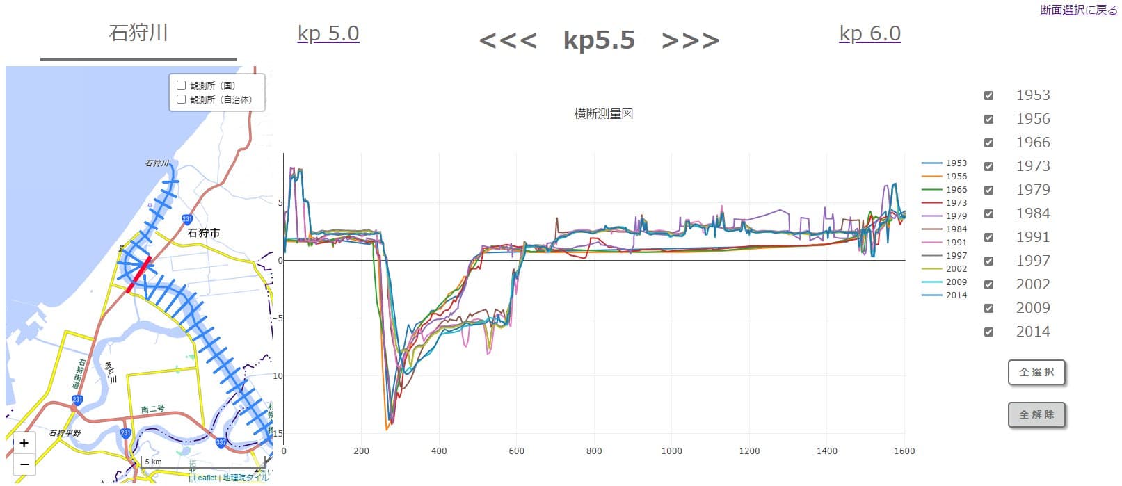
Screen design of a system that overlays river cross-sections from different years when a survey line is selected on the map

FY2017– (10 consecutive years) / Foundation

River disaster & environmental information-sharing system

We built and operate on the cloud a web system for searching and sharing river survey data, observations and photos on a map. After the 2018 Hokkaido Eastern Iburi Earthquake it was used by the survey team to share data. Today it continues as a management system for comparing river cross-sections across survey years.

AWSWeb GISDatabase

Screen design (specification stage). Base map: GSI tiles

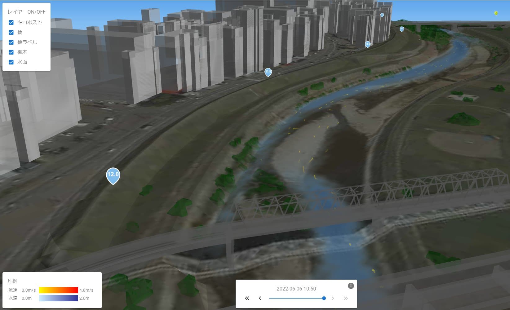
Web screen showing river flow velocity inside a 3D city model

2022 / Foundation

Web system for viewing floods in 3D

A browser-based simulator that displays river flow and depth inside a 3D city model, together with hazard spots and bridge locations.

3D city modelWebFlow visualization

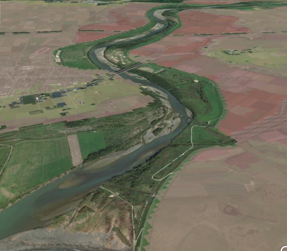
Expected inundation depth color-coded on a 3D map

2018–2019 / National research institute & engineering consultant

3D flood hazard map

A hazard map that overlays inundation simulation results on a 3D map with evacuation shelters, designed to help explain flood risk to residents.

3D visualizationInundation analysisGoogle Earth

Base map: Google Earth

Selected projects

  • 2016National research instituteOnline real-time inundation analysis system using iRIC
  • 2017Engineering consultantProgram sharing and version-control system
  • 2019UniversitySystem that automatically extracts basin and hydro-terrain data for any point
  • 2020UniversityFlood-forecasting program that runs automatically on real-time rainfall
  • 2022National research instituteEvacuation-route search reflecting how flooding spreads
  • 2022FoundationWeb system for managing and viewing river cross-section surveys
  • 2026In-houseComplete renewal of the iRIC web platform (iRIC ID, events, Academy)
  • 2026UniversityTerrain and rainfall data tools for a rainfall-runoff-inundation model

About our System Development service →

DATA

Our work in numbers

Projects per year

Counted by the year in our project numbers (our numbering changed partway, so it may differ from the fiscal year by up to one year). Only projects confirmed in both our ledger and project folders are counted. Projects spanning several categories are counted in each.

Clients

Engineering consultants
129
Foundations & public-interest corporations
39
National research institutes
33
Universities
29
Private companies & others
30

Talk to us about analysis and development

Computations or features beyond the public version of iRIC, integrating your own model, planning a workshop: tell us what you have in mind.

Contact us